Importing OpenStreetMap
Download map extracts from OpenStreetMap and use them as a planning basis for the heat network
Overview
VICUS Districts can download map extracts from OpenStreetMap (OSM) directly and display them as a planning basis. Among other things, buildings (optionally as 3D solids), streets and bodies of water are imported. The OSM extract serves as a background map for route planning and is at the same time the data basis for automatically generating consumers from OSM buildings.
Opening
The import can be started in two ways:
- via the menu Import > OpenStreetMap (OSM) …
- via the button
 OSM in the Import section of the Add geometry panel (right-hand side)
Import dialog
The Import OpenStreetMap (OSM) dialog displays an interactive world map. Use the mouse wheel to zoom into the target area and drag with the mouse button held down to move the extract.
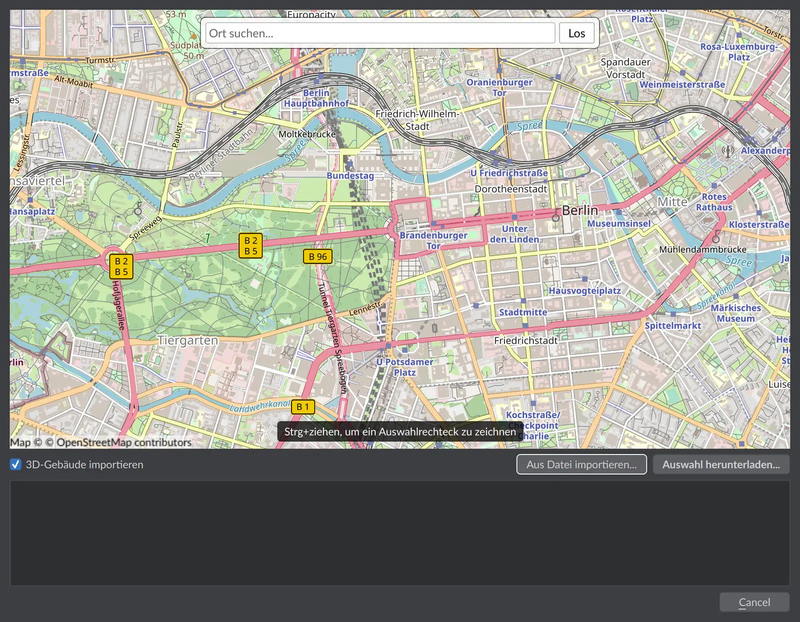
| Option | Meaning |
|---|---|
| Import 3D buildings | Enabled by default. Building footprints are extruded into 3D solids based on their estimated height. Without this option, buildings are shown as flat footprints. |
| Download selection… | Downloads the OSM data for the visible map extract from the server (internet connection required). |
| Import from file… | Loads an already downloaded OSM dataset from a .vicosm file – useful for working without an internet connection or for sharing within the project team. |
Progress and any messages are shown in the dialog’s log area.
What is imported
- Buildings – footprints from OSM, optionally as extruded 3D solids including address information
- Streets – street geometries as polylines
- Bodies of water and other areas – if present in the map extract
The imported OSM data appears as a separate entry in the navigation tree. Individual categories (layers) can be shown and hidden there via the visibility icons. The OSM data is a purely referential display – it is neither simulated nor modified.
Turning OSM buildings into consumers
Network consumers can be generated directly from the imported OSM buildings – including automatically calculated connection load and heat demand:
- In the Add geometry panel, switch to the
 OSM to consumer mode.
 - Select the desired buildings in the map view. Hold down the Ctrl key and drag a selection window to select several buildings at once. Individual buildings can be deselected again with a click.
- Several addresses within the same building can be merged automatically into a single consumer.
- Choose a building type and a building energy standard. From these, the specific heating power and specific heating demand are pre-filled; both values can be adjusted manually. Optionally, domestic hot water and cooling demand can be taken into account. The heated area is derived from the OSM footprint via the ratio of gross to net floor area.
- Specify whether the consumer is connected to a heat pump and, if applicable, enter the COP at design conditions – this affects the connection load on the network.
- Choose the target network (or create a new network).
- The summary page shows the gross and net floor area, connection load, heating power and heating demand for each building. After confirmation, the consumers are created as nodes in the network.
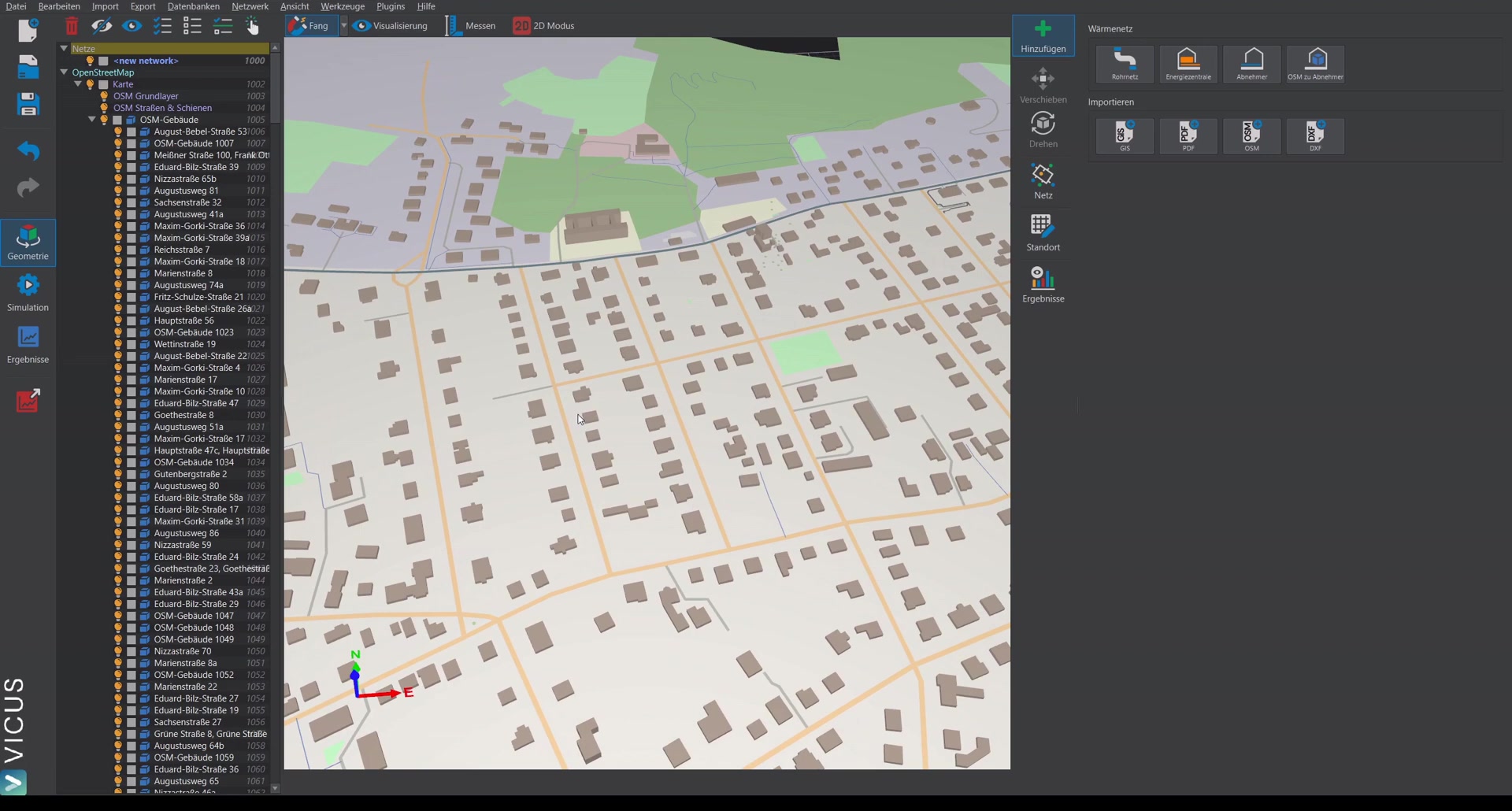
The generated consumers behave like manually created consumers: connection load and demand values can be edited afterwards in the Building demand tab.
Notes
- Coordinates: The map extract defines the geographic reference of the project. This is used, among other things, for the elevation query of the network nodes and for the GIS export.
- No terrain elevations: OpenStreetMap supplies no elevation information for the terrain. All nodes generated from OSM initially sit at z = 0, and the geodetic component in the pressure results is then zero. Run the elevation query after the import, once the network topology is in place.
- Data quality: This limitation concerns the building data: building heights and addresses come from OpenStreetMap and may be incomplete. Check generated consumers on a sample basis, especially for small secondary buildings (garages, sheds) that should potentially be deselected.
Important in practice
OpenStreetMap is a good, fast basis – but not an official source. Building heights are often only estimated, and an automatically generated consumer is only as good as the OSM footprint. So check the pre-filled heated area and connection load before using them for sizing, and deliberately deselect garages, sheds and secondary buildings so that they do not end up as consumers in the network.