Exporting a network as GIS data
Export pipes and consumers including calculation results as GeoJSON, Shapefile or GeoPackage
Overview
The GIS export writes the heat network as a georeferenced dataset – pipes as lines, consumers as points, each with complete factual attributes (dimension, length, demand values) and optionally the results of the steady-state calculation. This allows the network to be reused and documented in QGIS, ArcGIS or municipal GIS systems.
Opening
Menu Export > Network GIS data … (only visible when the network perspective is active).
Network and format
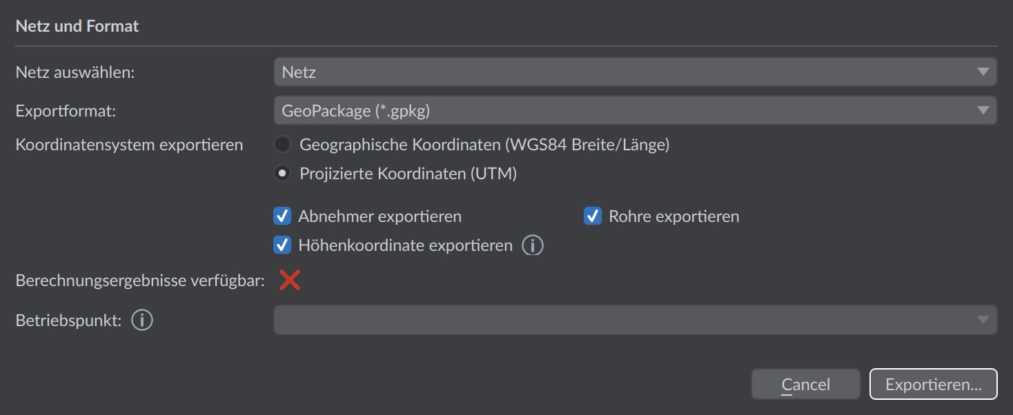
| Option | Default | Meaning |
|---|---|---|
| Select network | active network | With several networks in the project: the network to be exported. |
| Export format | – | GeoJSON (.geojson), Shapefile (.shp) or GeoPackage (.gpkg). |
Note on Shapefile: A Shapefile can contain only one geometry type – therefore either pipes or consumers can be exported, not both at the same time (note in the dialog). GeoJSON and GeoPackage support both in a single file. For Shapefiles, short attribute names are also used because of the field-name limitation (e.g. mflow_kgs instead of calculated_mass_flow_kgs).
Coordinate system
| Option | Default | Meaning |
|---|---|---|
| Geographic coordinates (WGS84 latitude/longitude) | selected | Standard format for GeoJSON (latitude/longitude based). |
| Projected coordinates (UTM) | – | Export in the UTM zone of the project – common for Shapefile/GeoPackage in the German planning context. For GeoJSON, the dialog shows a warning, since UTM does not correspond to the standard there. |
| Export elevation coordinate | enabled | Writes 3D geometries (with z coordinate). Disabled: pure 2D geometries. |
Data selection
| Option | Default | Meaning |
|---|---|---|
| Export pipes | enabled | Routes as line features. |
| Export consumers | enabled | Consumers as point features. |
| Operating point | – | Only active if results of the steady-state calculation are available: appends the result values of the selected operating point as attributes. |
Exported attributes
Pipes (lines)
| Attribute | Unit | Meaning |
|---|---|---|
id, name | – | ID and name of the route |
da, s, di | mm | Outer diameter, wall thickness, inner diameter |
DN | – | Nominal diameter |
length | m | Route length |
With calculation results (selected operating point), additionally among others:
| Attribute | Unit | Meaning |
|---|---|---|
mflow_kgs / vflow_m3h | kg/s or m³/h | Mass flux / volume flow |
v_ms | m/s | Flow velocity |
dp_mbar | mbar | Pressure loss of the route |
dpL_Pam, dpspec_Pam | Pa/m | Pressure loss per meter |
Qloss_kW, Qloss_W, qloss_Wm | kW, W, W/m | Heat loss (absolute and per meter) |
Tin_C, Tout_C | °C | Inlet and outlet temperature |
pin_bar, pout_bar (…ab, …ov) | bar | Pressures at inlet/outlet; the …ab variant including the geodetic component (operating pressure), …ov as pressure exceedance |
dpfiti_Pa, dpfito_Pa | Pa | Pressure loss of the fittings at inlet/outlet |
Consumers (points)
| Attribute | Unit | Meaning |
|---|---|---|
id, Name | – | ID and name of the consumer |
power_kW | kW | Connection load |
area_m2 | m² | Heated area |
Pheat_kW / Eheat_MWh | kW / MWh | Maximum heating power / annual heating demand |
Pcool_kW / Ecool_MWh | kW / MWh | Cooling power / cooling demand (if present) |
Edhw_MWh | MWh | Domestic hot water demand (if present) |
With calculation results, additionally among others mass and volume flow, pressure loss, heat loss, inlet/outlet temperature, temperature difference (dT_K), pressures as well as, for heat-pump consumers, condenser power (Qcond_W) and COP.
Typical workflow
- Perform the steady-state calculation for the relevant operating points.
- Open Export > Network GIS data …, choose the network and format.
- Set the coordinate system to match the target system (GIS systems in Germany mostly UTM, web maps WGS84).
- Choose the operating point for the result attributes and export.
In practice
For municipal GIS systems in Germany, choose Projected coordinates (UTM) – lengths and areas can be evaluated metrically and directly there, whereas WGS84 degree coordinates are unsuitable for this. WGS84 is the right choice for web maps. Make sure that the geographic reference of the project is correct before you export, otherwise the network ends up in the wrong place in the GIS.