District Heating Software Compared: Tools for Heat Network Planning
Heat planning and district heating network calculation play a central role in the decarbonization of neighborhoods, urban districts and entire municipalities. Without reliable simulation results, neither the hydraulic design nor the economic feasibility of a heat network can be verified with confidence. With VICUS Districts, planning offices, utilities and municipalities have access to a powerful desktop software for Windows that allows planning conventional district heating networks as well as low-temperature district heating networks (5GDHC) quickly, precisely and intuitively — from the initial concept and variant studies to detailed thermo-hydraulic annual simulation.
In contrast to purely web-based online tools, VICUS Districts runs locally on your computer. This has decisive advantages: your project data stays with you, the software works even without an internet connection, and the powerful numerical simulation core can dynamically simulate even large networks with several hundred consumers in acceptable time — without the performance and complexity limits of browser-based tools.
This article provides an overview of the most important software tools for district heating planning and explains how VICUS Districts covers the entire planning process — from heat demand density to pipe sizing.
Software Tools for Heat Network Planning at a Glance
A wide variety of programs exist on the market for different phases of heat network planning. They can be broadly divided into three categories:
- Tools for potential analysis — e.g. Hotmaps, Thermos or GIS-based tools to identify suitable areas and heat demand densities.
- Online tools and web applications for concept development — e.g. nPro, Sophena or simple Excel-based tools for steady-state preliminary sizing.
- Desktop software for dynamic simulation — e.g. STANET, EcNetz, THENA, TRNSYS, Modelica/Dymola and VICUS Districts.
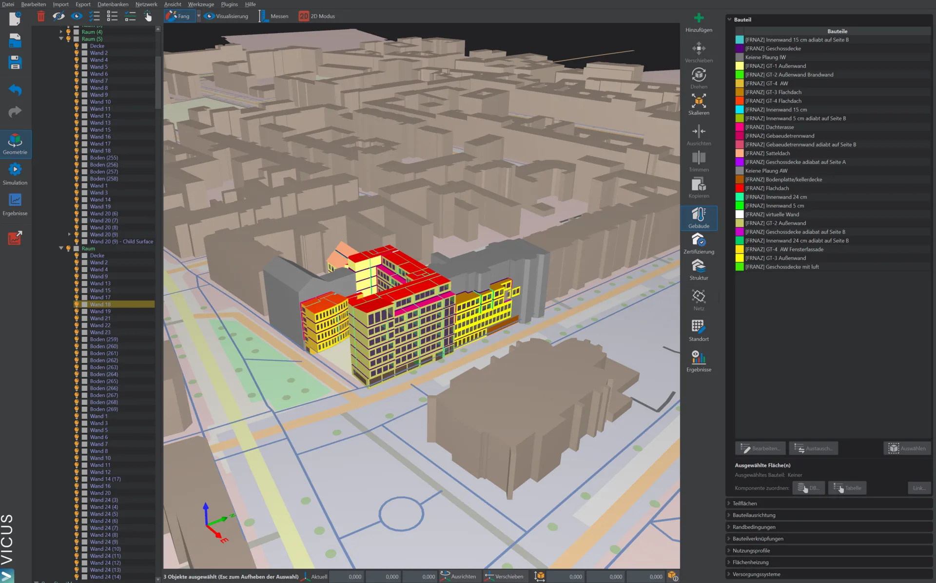
As an integrated planning and simulation software, VICUS Districts covers several of these phases in a single desktop application. Users do not need to switch between different tools but can work end-to-end in one environment — from importing existing data to running a dynamic annual simulation. This saves time, avoids data breaks and significantly accelerates the creation of variant studies.
Potential Analysis, Heat Demand Density and Load Profiles
Every heat network planning starts with the question: Where does a heat network actually make sense? The most important indicator is the heat demand density — given in MWh per route meter and year — and the resulting linear heat density.
The higher the heat demand density, the more economically a conventional district heating network can be operated. Conversely: the lower the heat demand density, the more strongly heat losses weigh in relative terms — and the more attractive concepts such as low-temperature district heating become, which can actively use heat gains from the ground (see also our article on the fundamentals of low-temperature district heating).
With VICUS Districts, load profiles and heat demands can be created directly in the tool or imported from external sources. Supported are:
- Standard load profiles for residential and non-residential buildings
- Hourly load profiles from measurement data or external simulations
- Energy demand for heating, domestic hot water and cooling
- Scaling via dwelling units, living area or connected loads
All inputs can be flexibly captured via GIS data, Excel sheets or the integrated user interface. This makes it possible to build a reliable heat demand model in just a few minutes — even for projects with hundreds of consumers.
Heat Network Planning with GIS Integration
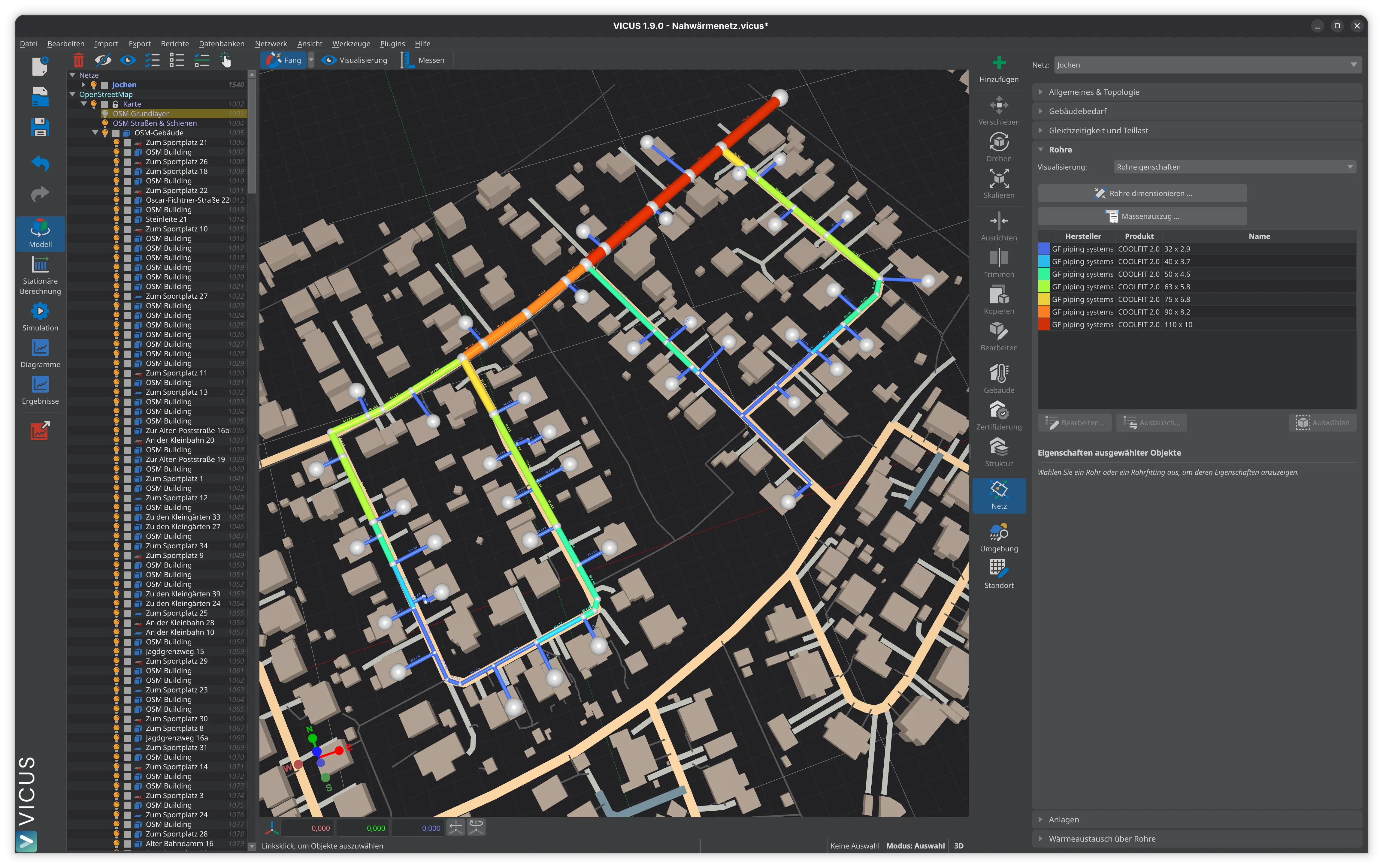
After the potential analysis comes the actual route planning. Here, heat sources, energy plants and consumers must be connected by a pipe network. Traditionally, this is done in CAD or GIS software, after which the data must be transferred to a calculation tool — a time-consuming and error-prone process.
VICUS Districts integrates route planning directly into the simulation environment. This eliminates data export between different tools entirely. The following features support the workflow:
- Import of OpenStreetMap data as a background map for any region
- Import of DXF, Shape and PDF plans for existing networks
- Direct drawing of routes, pipes, nodes and energy plants in the editor
- Automatic calculation of route lengths and topology
- Multiple energy plants and heat sources combinable in one network
- Support for different network hydraulics (supply and return, ring networks, meshes)
This makes it possible to model even large networks with several hundred consumers in a short time. The tight integration of geometry, hydraulics and energy supply is one of the central advantages of VICUS Districts compared to purely text-based input tools.
Dynamic Heat Network Simulation and Pipe Sizing
The heart of VICUS Districts is the thermo-hydraulic annual simulation. In contrast to purely steady-state design methods, pressure losses, temperatures and heat losses are calculated on an hourly grid throughout the entire year. This provides a realistic picture of network operation under varying loads — and allows weak points to be identified before they occur in real operation.
The software supports, among other things:
- Automatic pipe sizing based on prescribed specific pressure losses (e.g. 100 Pa/m)
- Heat loss calculation for insulated and uninsulated pipes — see also our deep dive on thermo-hydraulic simulation
- Detailed soil model for the calculation of heat gains and losses to the ground matrix
- Pump sizing and calculation of pump electricity demand
- Consideration of various heat sources (boilers, CHP, heat pumps, geothermal, waste heat)
- Steady-state pre-calculation for fast first results, then dynamic refinement
Compared to classic tools such as STANET or EcNetz, VICUS Districts offers decisive advantages especially for the planning of low-temperature and 5GDHC networks, since the ground coupling and the heat gains from the uninsulated pipe network are directly included in the simulation.
Planning Cold District Heating and 5GDHC Networks
With the increasing spread of low-temperature district heating networks (5th Generation District Heating and Cooling, 5GDHC), the requirements for planning software are also increasing. Classical tools quickly reach their limits here, as they can map neither the bidirectional energy flows nor the heat gains from the ground.
VICUS Districts was developed from the start with 5GDHC networks in mind. The following features are specifically optimized for low-temperature district heating:
- Sizing of ground heat collectors and borehole heat exchanger fields as a central heat source
- Simulation of passive and active hydraulic concepts
- Bidirectional operation with prosumers (heating and cooling in the same network)
- Calculation of heat gains from the uninsulated pipe network based on a validated soil model
- Economic evaluation in comparison with conventional solutions
This way, VICUS Districts covers the complete planning process from the initial concept to detailed planning — and is suitable for both classical district heating networks and innovative low-temperature concepts.
Conclusion: Why VICUS Districts?
The digital planning of heat networks is a complex process that requires integrated software. VICUS Districts combines GIS-based route planning, automatic pipe sizing, dynamic annual simulation and economic evaluation in a single, intuitively operable application. This makes it a powerful tool for everyone who wants to plan heat networks quickly, precisely and future-proof — from conventional district heating networks to innovative 5GDHC systems.
Want to try VICUS Districts in practice?
- 30-day free trial — Full version without restrictions
- Book a personal demo — Live walkthrough with our expert team
- Learn more about VICUS Districts — Features, licenses and use cases
Ready to try it yourself?
Experience VICUS Software live — in a personal demo or download it right away. Sustainable planning starts here.